Projecting global and regional Altimeteric Sea Level Acceleration to year 2050
|
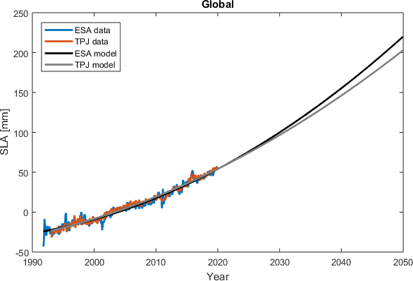
More than 27 years of high precision
satellite altimetry enables analysis of recent changes in global mean sea
level (GMSL).
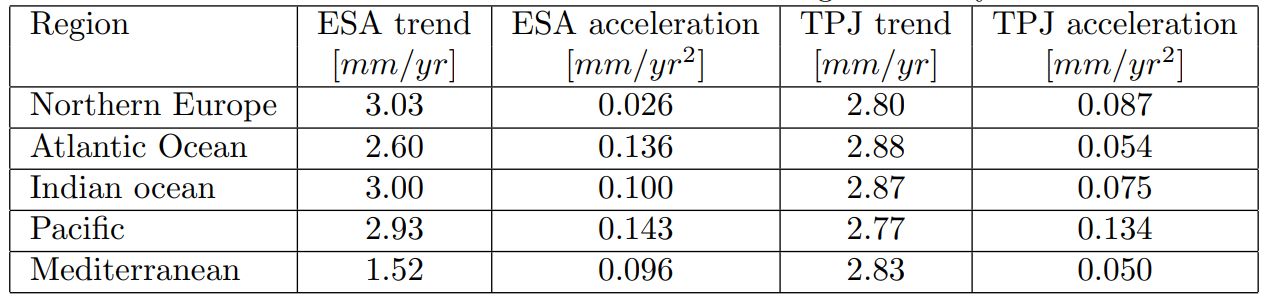
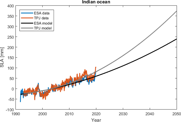
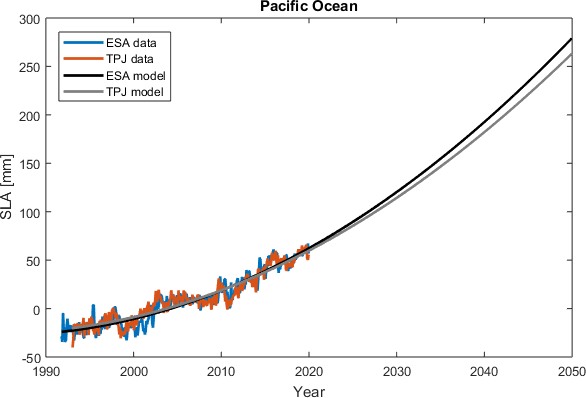
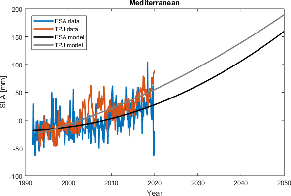
Initial test on regional sea level projections based on regionally estimated linear and quadratic terms
has been added for various regions to test the possibility of projecting recent regional sea level.
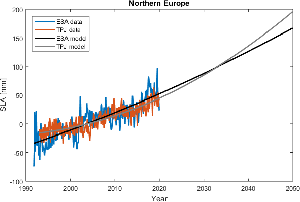
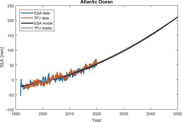
It contains six timeseries of data along with a 2050 projection of sea levels.
The regions included in this analysis are listed in Table 1.
The data used for this analysis are from the French-American satellites TOPEX/Poseidon,
Jason-1, Jason-2, Jason-3 (TPJ data) and from the European satellites ERS-1, ERS-2, Envisat, CryoSat-2
(ESA data).
|
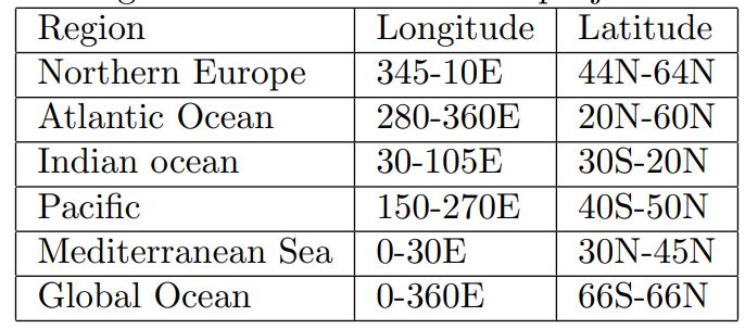
Northern Europe
Atlantic Ocean
Indian Ocean
Pacific Ocean
Mediterranean Sea
Global Ocean
|
Article:Veng and Andersen, Consolidating Sea level acceleration ( Click here ) |